
Town of Monroe Street Directory Walkthrough
Start with the address itself, not a conclusion about who is present there. Town of Monroe has overlapping postal and municipal labels, so a Monroe mailing line may need to be distinguished from the Village of Monroe or the Village of Harriman before a record is requested. The sequence below builds an address-based property trail and keeps ownership, mailing and occupancy questions separate.
- Use the USPS ZIP Lookup Tool to standardize the street, city, state and ZIP. It confirms delivery formatting, not a municipal boundary or a person at the address.
- Enter the standardized address into the Orange County GIS address search. Complete the City, State and ZIP fields when possible, choose the correct autocomplete candidate, and note the municipality attached to the mapped parcel.
- Compare that candidate with Orange County Parcel Information and the Town assessment roll. Capture the tax-map parcel, property location, current owner name, current owner address and deed book/page separately.
- Take the parcel and deed reference to the Orange County Clerk record room for the recorded instrument. The deed, not the assessor listing or map pin, documents a recorded transfer. None of these steps alone establishes that a particular person occupies the property.
Keep a short research note with the exact search text, selected GIS candidate, parcel identifier and access date. That makes it easier to revisit a result when a street suffix, unit, village label or assessment year changes.
Town of Monroe Street Directory Record Coverage
Different custodians answer different address questions. The table is a routing guide for a Town of Monroe street search, not a combined resident roster. A parcel number is especially useful because it ties together the assessment roll, County map and deed research more reliably than a street name alone.
| Address-keyed source | Custodian or tool | Useful fields | Best access route |
|---|---|---|---|
| County parcel record | Orange County Parcel Information | Owner, address, tax map, municipality, assessment, photo/report options | Free public access, available 24 hours a day |
| Annual assessment roll | Town of Monroe Assessor | Property location, owner name and mailing address, class, parcel, assessment, deed book/page | Public inspection and the published 2026 final roll |
| Parcel map and attributes | Orange County GIS | PIN, PrintKey, SWIS, acres, municipality, geometry and coordinates | Viewer, parcel detail and map-selection tools |
| Recorded land instruments | Orange County Clerk | Deeds, mortgages, satisfactions, subdivision maps, liens and judgments | Record-room inquiry using town and section/block/lot information |
| Building and code records | Town Building Department | Releasable permits, inspection reports or certificates by address/date | GovWell account route or focused Town FOIL request |
| Voter-registration records | NYS Board of Elections | Public inspection or permitted file fields under election rules | Supervised inspection or written BOE FOIL request with election purpose |
The County Clerk identifies deeds, mortgages, subdivision maps and related land records as clerk holdings. The Town Building Department maintains permit, complaint, inspection and code-enforcement material, but the public GovWell landing page did not publish a stable public field schema. For that kind of address history, specify the parcel, address, date range and record type instead of asking the Town to create a general answer.
Town of Monroe GIS and Assessor Search Fields
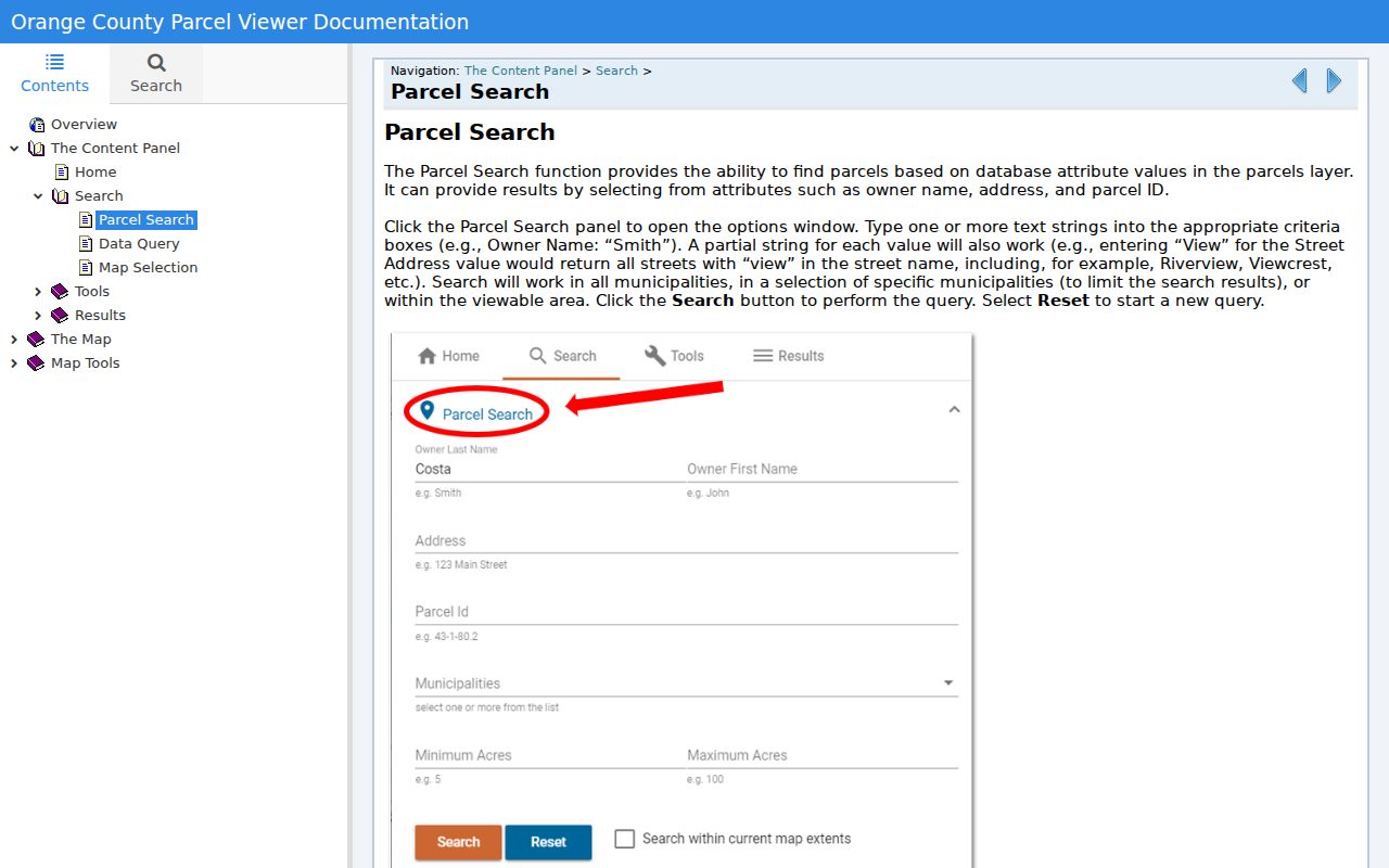
Orange County uses more than one search surface. Parcel Search supports partial owner, address or parcel-ID text and can be narrowed by municipality. The Find Address tool is more structured: it accepts an address with City, State and ZIP, offers autocomplete and can show several potential matches when the text is incomplete. Record which candidate was selected before copying any parcel detail.
| Tool | Fields or actions | What the result can supply | Town of Monroe caution |
|---|---|---|---|
| GIS Parcel Search | Owner, address, parcel ID, partial text, municipality, Search/Reset | Candidate parcels and attributes | Partial text can broaden the match; try the Town, Village of Monroe and Harriman labels where relevant. |
| GIS Find Address | Street address, City, State, ZIP, Locate and autocomplete | Candidate map location and potential-match choices | An address need not be complete, so do not treat the first geocode as final without review. |
| County Parcel Information | Owner name, address, tax-map number or municipality | Owner, parcel, assessment, tax map, reports and photos | Match names and entity suffixes exactly; a current assessment is not a deed index. |
| Assessment roll | Tax-map parcel and printed property record | Location, owner, mailing address, class, acreage, assessment and deed reference | The annual record can lag a later conveyance. |
| GIS Data Query and Map Selection | Layer field query, results table, selected map area or buffer | Mapped parcel context, statistics and nearby results | Layer limits, map scale and the disclaimer affect what a result means. |
For an entity name, compare its spelling and suffix across the County result, the roll and the recorded deed. For a unit address, preserve the unit exactly as the Postal Service and source record show it. That modest discipline avoids merging distinct candidates along a Town of Monroe corridor.
Town of Monroe Property Location and Mailing Address
The 2026 Town of Monroe final assessment roll intentionally prints property location and current owner address as separate fields. The first is the situs used for the assessment record. The second is a correspondence destination and may be a post-office box, an agent, a suite or a location outside the Town. Reading them as one field creates a false occupancy claim.
A sample roll entry for 845 St Rte 17M illustrates the distinction: the property location is the Route 17M address, while the listed owner mailing address is 1 Shinev Ct Lt 1 Zuckerman Sub, Monroe NY 10950. The entry also supplies parcel 201-1-2.1, class, acreage, assessment and deed book/page. It is a parcel record, not evidence about a household at either address.
Research tip. Copy both printed address fields, label each one, and then compare the tax-map parcel with the recorded instrument. An owner mailing address can help distinguish records, but it should never be relabeled as the property location or a residence.
Town of Monroe Parcel Information and Image Mate
Orange County Image Mate supplements the County parcel search with RPS fields, tax maps and photographs. The County says its Parcel Information service provides free public access around the clock for owner, parcel, assessment, tax-map, photo and comparable searches. Image Mate says its assessment data is updated weekly, except for Warwick and Newburgh, which makes it useful for a current assessment check.
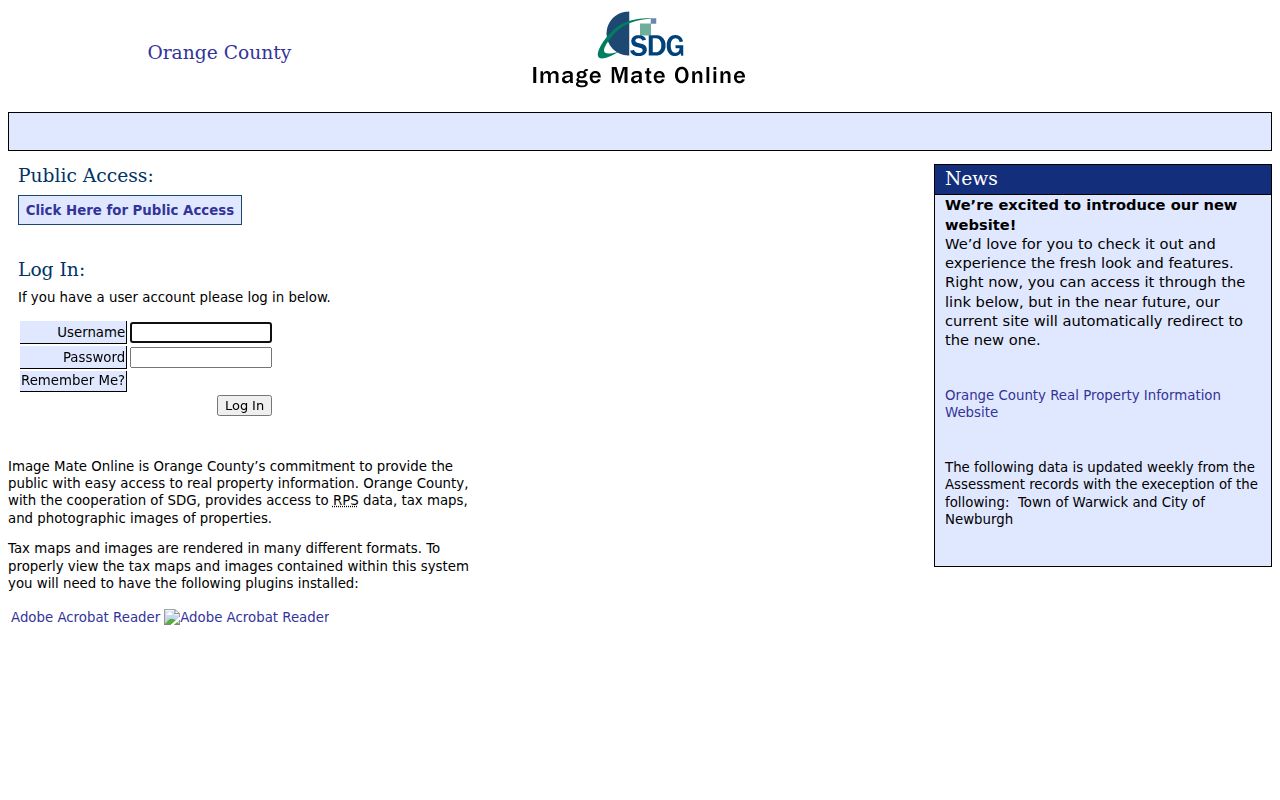
Weekly assessment updates do not turn Image Mate into a deed index. Use a parcel result to collect the site address, owner field, municipality and tax-map context, then confirm the deed book/page at the Clerk when the recorded transfer matters. The Assessor's public 2026 roll is another useful snapshot and is available through the Town's assessment page during the stated inspection process.
Town of Monroe GIS Parcel Search Limits
Orange County's Parcel Search help describes owner, address and parcel-ID searching, including partial text and municipality selection. The wider viewer also offers Data Query, Map Selection, Parcel Details, results tables, draw and measure tools, a buffer, print/export, basemaps and layers. These controls are helpful for placing an address in its parcel context before an office request.
The parcel service exposes attributes such as PrintKey, SWIS, PIN, GIS acres, municipality, geometry and coordinates. Parcels and aerial imagery are scale-dependent, and the County disclaimer treats the map as informational and provided as-is. A map screenshot cannot settle a legal boundary, road right-of-way, lot split or address correction; use the Clerk, Assessor, municipal office or a licensed surveyor for that question.
Town of Monroe Address History Through Building Records
The Town Building Department regulates building, fire, energy, planning/zoning and flood matters, and it maintains permit, complaint, inspection and code-enforcement records. Its applications connect to GovWell, where first-time users need an account. The research did not identify a complete public permit index or public list of searchable fields on the static portal, so it would be inaccurate to promise an address search there.
Instead, use the department route for an available application or send a focused FOIL request that identifies the address or parcel, a narrow date range and the record type sought, such as permits, inspection reports or certificates. Ask for releasable existing records and keep the reply with the request date. A no-record response means no responsive record was located in that request, not that no activity ever occurred at the site.
Town of Monroe Street Directory Deed Trail
For a backward property trail, the Orange County Clerk record room is the next stop after a parcel match. Bring the Town and section/block/lot information when available, together with the printed owner name, situs, deed book/page and any legal description or subdivision information. The County's deed-sale guidance warns that the County makes no title-quality representation, so the recorded instrument and its legal description need to be read rather than assumed from a search line.
The Clerk holds deeds, mortgages, satisfactions, subdivision maps, mechanic liens and judgments. Published deed examples include a $40 base charge plus $5 per page and cross-reference charges, while name searches are priced by name and two-year period. Ask the record room how an older or unusual instrument is indexed. For early Town of Monroe land questions, OCGS maintains grantor/grantee indexes from 1703 to 1891, mortgage indexes from 1703 to 1869 and 1850 Orange County maps with farmer names. Those are discovery aids; the clerk's recorded document remains the authority.
Town of Monroe Street Addresses in Voter Records
New York election records use address components, including street, direction, city, ZIP and ZIP+4, and can hold a mailing address separately from a residence address. The public voter tool is for a registered New York voter and asks for county, name, date of birth, ZIP and address information. Its dynamic result behavior means a no-match should not be treated as proof that a person is absent, and it is not a block-by-block publication tool.
Election Law permits supervised public inspection while excluding driver-license, DMV non-driver photo-ID, Social Security and facsimile information. A request for a voter list or file goes through the NYS Board of Elections FOIL process, requires the election-purpose statement specified by law and uses the agency's GovQA route. Public inspection is listed in Albany on weekdays from 9:00 a.m. to 4:30 p.m.; the state describes the delivery format as an ASCII comma-delimited zipped file. Confidential voter records and protected identifiers remain excluded.
Town of Monroe Street Search Terms
These record terms keep a street-directory search tied to the correct land reference instead of a guessed household identity.
- Parcel
- A tax-map unit of land used by the assessment and GIS systems. The parcel identifier is a strong bridge between map, roll and deed research.
- Situs address
- The property location used to identify the site. It is not automatically the owner's mailing address or proof that a named person is there.
- Plat
- A recorded subdivision or parcel map. It can help explain lot lines, blocks or a legal description, but the official recorded map should be reviewed through the Clerk.
- Criss-cross directory
- A reverse-style historical directory arranged by address rather than only by name. It can be a useful past-household lead, then should be checked against the source year and other records.
Old addresses can also be affected by road-name changes, subdivisions, boundary changes or different municipal labels. The Town's history includes boundary changes in 1863 to 1865 and an 1889 reconfiguration, so an older Monroe reference may not correspond neatly to a present parcel or village line.
Town of Monroe Street Directory Use Limits
Address records can identify a property, an assessment owner field, a mailing destination or a recorded transaction. They do not create a reliable list of everyone in a building, a routine, a family relationship map or a claim about occupancy. DMV personal data and confidential voter information follow separate legal protections, and a public map does not remove those boundaries.
Lawful use. Use Town of Monroe address records for lawful personal research, property history, civic transparency or an estate question. Do not use them to monitor, intimidate, stalk, harass or harm anyone; direct a privacy, redaction or correction issue to the office that holds the record.
If a street result looks inconsistent, return to the custodian instead of merging records. Confirm the municipality, parcel, source date and recorded instrument, especially where the postal line says Monroe but the governing context is Harriman, the Village of Monroe or an adjacent community.