
Town of Monroe ZIP Code Coverage by Area
The official material supports two core postal relationships and one important adjacent-area warning. The table records confirmed examples, rather than claiming that a whole named municipality receives a single delivery code. No official parcel-level boundary map or complete delivery-point list for the Town was located, so an individual USPS lookup remains necessary for every address.
| ZIP | Areas Covered | Post Office | Notes |
|---|---|---|---|
| 10950 | Town Hall, Village of Monroe core examples, Monroe Senior Center and American Legion examples | Monroe Post Office, 787 State Route 17M | Core Monroe mailing examples; validate each parcel individually. |
| 10926 | Harriman Village Hall and Town sewer-page Harriman examples within the Town | Separate service point not confirmed in the inspected research | Harriman examples are within Town of Monroe, but postal and municipal boundaries are not identical. |
| 10949 | Adjacent Palm Tree/Kiryas Joel postal clue, including an official regional PO Box example | Not confirmed as Town coverage | Do not assign this ZIP to Town of Monroe without USPS address validation. |
| Other Orange ZIPs | Possible regional delivery areas shown in County or USPS material | Varies by address | Research gap: test one address at a time, not through a generalized Town table. |
The Monroe Post Office listing places the service point at 787 State Route 17M, Monroe NY 10950-9998. It is evidence for that post-office address and the listed Monroe examples, not a drawing of every delivery route or municipal line.
Town of Monroe ZIP Code Geography and Municipal Lines
Town of Monroe surrounds the Villages of Monroe and Harriman, while Orange County records can also use a municipal label, school district, fire district or tax-map field. The Orange County election-district map identifies Town Hall, the Monroe Senior Center and American Legion with Monroe 10950 addresses. It identifies Harriman Village Hall at 1 Church Street, Harriman 10926. Those are reliable examples, not an instruction to assign every Town address to either code.
The 10949 caution matters because a postal city line can say Monroe for an adjacent Palm Tree/Kiryas Joel example. Postal names are delivery conventions; they do not settle which local government or assessment roll covers a property. When records conflict, preserve the USPS result, then rely on the parcel's municipality and tax-map context for local record routing.
Geography check. A delivery ZIP can cross municipal borders, and a municipal boundary can include addresses with more than one postal label. For Town of Monroe research, treat the ZIP, municipality, village and parcel as separate fields.
Town of Monroe ZIP Code Directory Workflow
Use this ordered process to test a single address. It emphasizes verification rather than assembling a broad list from a ZIP, because neither the County parcel tool nor the assessment roll was documented as a townwide ZIP filter in the research.
- Run the street address through the USPS ZIP Lookup Tool. The service supports address, city/state and cities-by-ZIP searches, and it warns that a result does not confirm a person or business.
- Put the standardized address into Orange County GIS Find Address. Include City, State and ZIP, review autocomplete and select the correct potential match when more than one candidate appears.
- Inspect the GIS parcel detail and note the municipality, PIN, PrintKey or SWIS as available. This step tests the local context that a postal result cannot supply.
- Use County Parcel Information by address, owner, tax-map number or municipality to compare the parcel and assessment fields. Check the Town assessment roll for the printed property location and owner mailing address.
- If a public voter tool is appropriate for the user's own election purpose, use its ZIP and address fields only as directed by the State. Do not treat a no-match as proof about a person or an address.
Once a parcel is confirmed, the Town of Monroe street directory has the detailed address-to-parcel and deed-room walkthrough. That separate workflow is preferable to trying to infer a street record from postal geography alone.
Town of Monroe GIS Address Fields for ZIP Checks
Orange County GIS supports an address tool that uses a structured search rather than only a place name. Incomplete entries can return a potential-matches popup, so save the selected candidate and the date checked. Parcel Search also accepts owner, address or parcel ID text, supports partial text and allows municipality selection, which is useful when Monroe and Harriman labels need to be separated.
| GIS route | Search fields or controls | Use after a postal result | Limitation |
|---|---|---|---|
| Find Address | Street address, City, State, ZIP, Locate and autocomplete | Choose a candidate map location and compare its local label | Incomplete text can produce multiple potential matches. |
| Parcel Search | Owner, address, parcel ID, partial text, municipality, Search/Reset | Find the parcel and its attributes after address normalization | Partial terms broaden results; municipal labels vary. |
| Parcel Details | Selected parcel result | Read PIN, PrintKey, SWIS, GIS acres, municipality and map context | Display attributes are informational, not a legal survey. |
| Data Query or Map Selection | Layer query, result table, map selection and buffer | Review map context around the selected parcel | Results depend on layer scope, scale and mapping limits. |
Use the GIS result to identify a candidate parcel, not to declare the legal extent of a Town line. The County describes its parcel map and aerial layers as scale-dependent and informational. A legal boundary, right-of-way, split or correction belongs with the relevant Clerk, Assessor, municipal office or licensed surveyor.
Town of Monroe ZIP Code and Assessment Roll Fields
The 2026 final assessment roll is an annual property record, not a ZIP directory. Its useful fields include tax-map parcel number, property location and class, current owner name, current owner address, school district, parcel size, assessment, exemptions, special districts and deed book/page. The roll header identifies the Town of Monroe and Village of Monroe context, while individual records still need to be read one parcel at a time.
Most importantly, property location and current owner address are printed separately. The property location is the situs in the assessment record. The current owner address is the correspondence destination and may differ, including a post-office box, suite, agent or out-of-town address. A postal code attached to the mailing field must not be substituted for the property's local jurisdiction or treated as evidence of who is at the property.
Mismatch check. If USPS, GIS and the roll seem to point in different directions, write down the street format, selected GIS candidate, parcel number, municipality, property location and mailing address. Ask the Assessor or appropriate custodian about the record instead of forcing the fields to match.
Town of Monroe ZIP Code Searches in Public Records
The public tools do not all handle postal information the same way. USPS verifies delivery formatting. GIS accepts address, City, State and ZIP to find a candidate. County Parcel Information is documented for owner, address, tax-map number and municipality, rather than a ZIP-only Town search. The Town roll is a printed property snapshot. This means an address-first search is more dependable than assuming a whole-code result represents the Town.
New York's voter lookup asks for county, last name, first name, date of birth, ZIP and address information, but it is a convenience service for a registered New York voter and the page's exact result behavior is dynamic. For a voter list or record set, the NYS Board of Elections FOIL route requires a written request and the election-purpose statement required by Election Law. Public inspection is supervised, while driver-license, DMV non-driver photo-ID, Social Security and facsimile data are excluded. County enrollment statistics are aggregate county reports, not Town of Monroe population figures.
Town of Monroe Post Office as a Postal Starting Point
The USPS Monroe Post Office listing identifies the facility at 787 State Route 17M, Monroe NY 10950-9998, with a published phone number and listed service hours. It is a good official starting point for checking the local service point, but it does not replace address-specific validation through the Postal Service lookup tool.
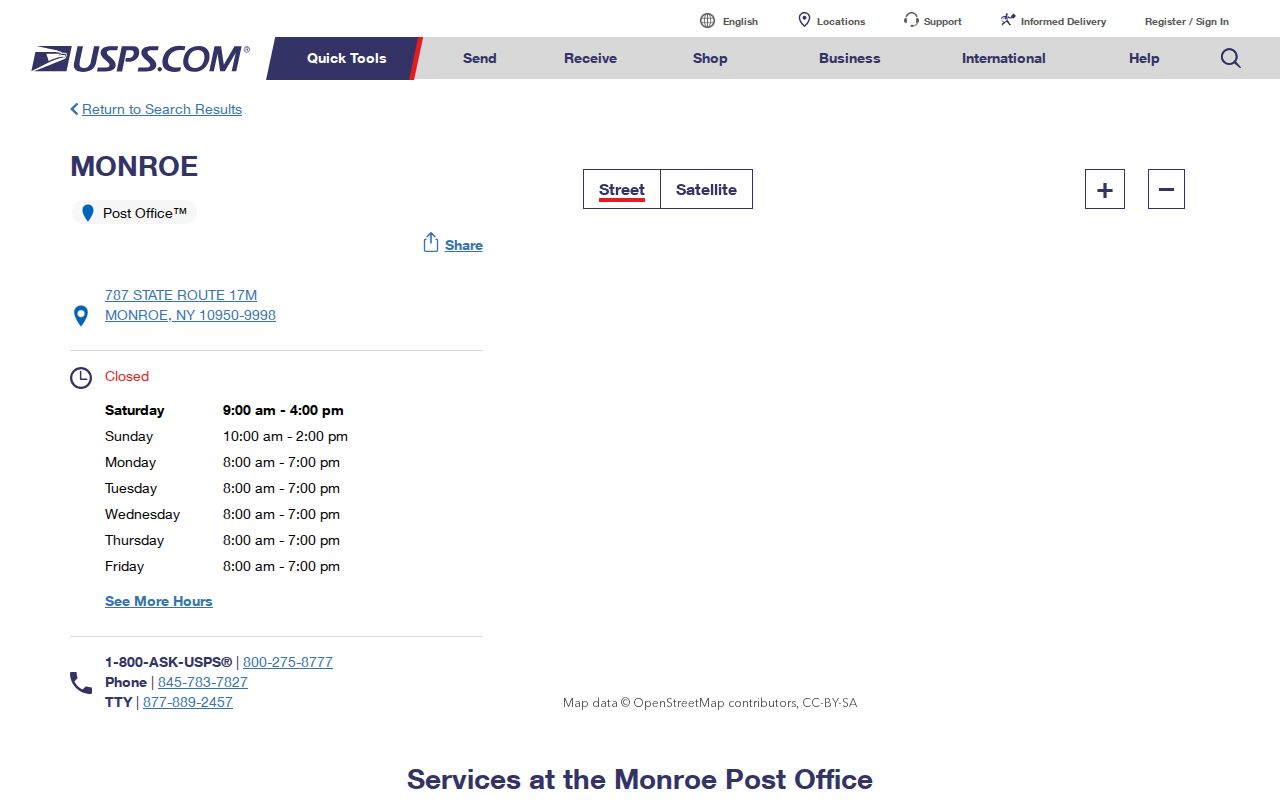
Use a mailing address exactly as USPS returns it when corresponding with a custodian, then retain the mapped municipality and tax-map parcel in a separate note. That preserves the difference between a post-office service point, a delivery label and the Town record system.
Town of Monroe ZIP Code Candidate Selection
Orange County GIS address-search help shows the fields used to locate an address: address, City, State and ZIP, followed by Locate and autocomplete behavior. An incomplete entry can generate potential matches. Choose the match that corresponds to the standardized USPS address, then review the parcel detail and municipality rather than relying only on the map pin.
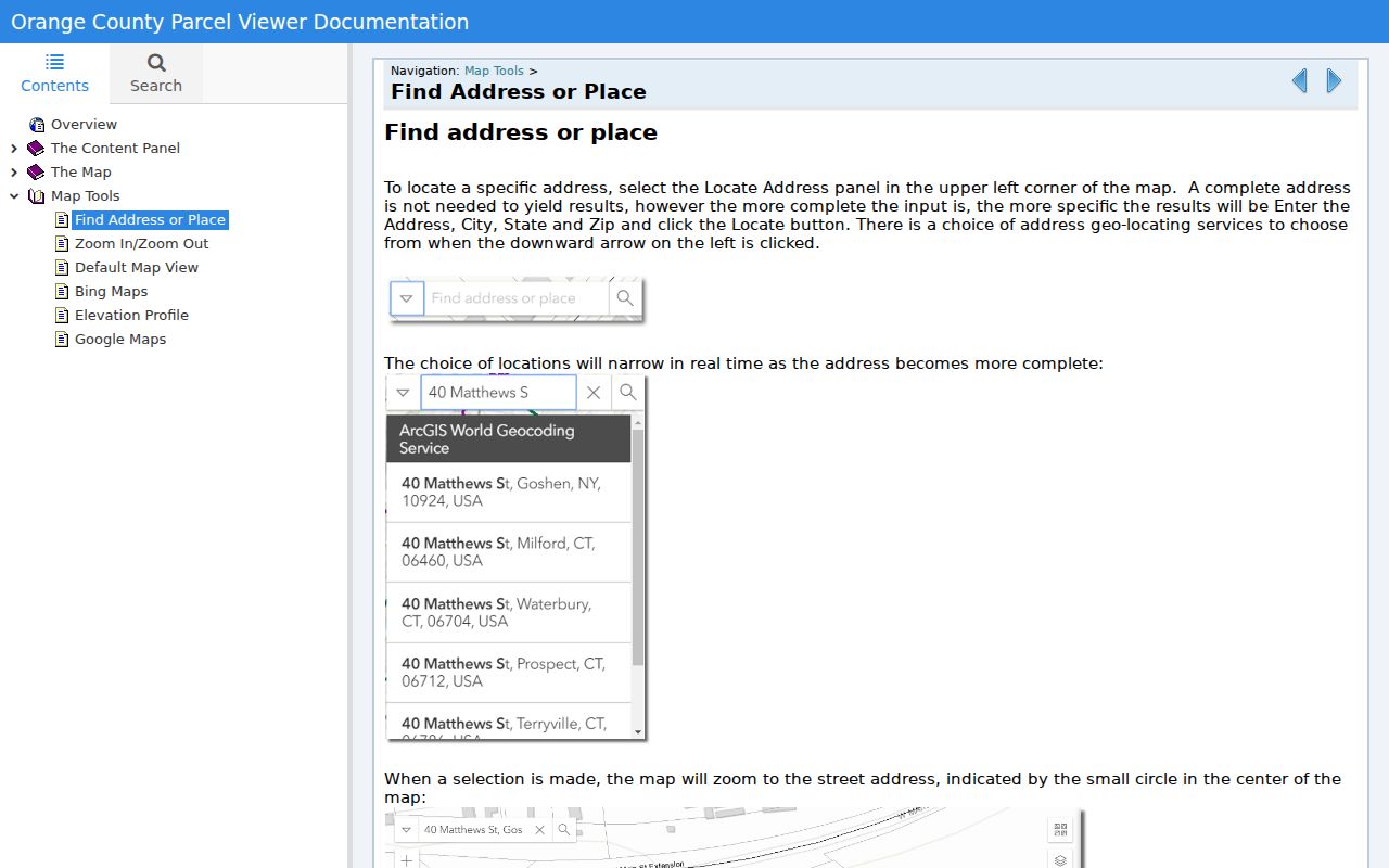
Save the candidate's parcel identifiers with the source date. A later map update, address correction or new assessment year can change how the address displays. The County viewer is useful for comparison, but its disclaimer and scale limits mean it is not a legal boundary record.
Town of Monroe ZIP Code Terms
These postal terms help separate a mailing route from the Town, Village, and parcel fields used by local records.
- ZIP
- A Postal Service delivery-routing code. It helps standardize mail but does not by itself establish a municipal boundary, parcel ownership or residence.
- ZIP+4
- An added four digits that refine delivery routing beyond the five-digit base. New York voter-address components may include it, but it is not a substitute for the parcel number.
- PO-box ZIP
- A delivery code used for post-office boxes. It can differ from the code used at a physical property location.
- Carrier route
- A Postal Service delivery grouping used for moving mail. It is a routing concept, not a Town, Village or tax-map boundary.
Neither a special postal code nor a carrier route was confirmed in the inspected Town of Monroe material as a reason to generalize coverage. The practical rule is simple: preserve the actual address and validate it through USPS, GIS and the parcel record.
Town of Monroe ZIP Code Mismatch and Use Limits
A Monroe postal line may appear with a Town, Village of Monroe, Village of Harriman or adjacent-community question behind it. The Town's historical boundary changes and its present Village relationships make it especially important not to collapse postal geography into government geography. Regional health statistics reported by ZIP are county-level figures and should not be retold as Town population counts.
Use postal and public-record tools for lawful address verification, civic questions, family history or property research. Do not combine public fragments into a private household profile, distribute protected address information or use an address result to monitor, stalk, harass or harm anyone. When an address needs correction or a record is protected, contact the office that maintains it through its official route.